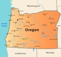
 Oregon (i/ËÉrɨɡÉn/ ORR-É-gÉn) is a state in the Pacific Northwest of the United States. It is bordered on its west by the Pacific Ocean, on its north by Washington, on its south by California, on its east by Idaho, and on its southeast by Nevada. The Columbia River delineates much of Oregon’s northern boundary, and the Snake River delineates much of the eastern boundary. It is one of only three states of the contiguous United States to have a coastline on the Pacific Ocean.
Oregon
Tagged with: Oregon


Leave a Reply